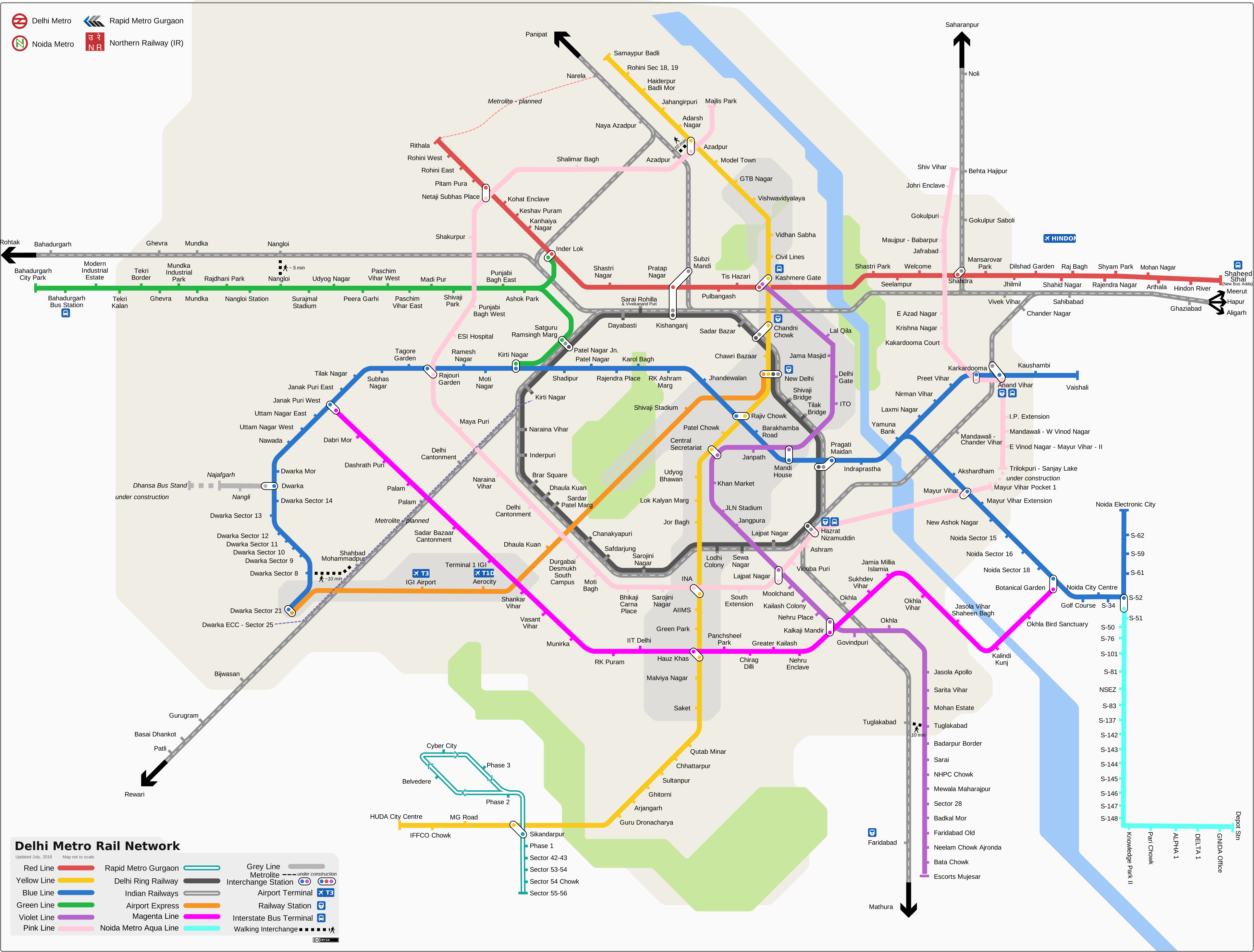
About the Delhi Metro map
The map shows the rapid transit system serving Delhi and its satellite cities (Noida, Gurugram, Faridabad, Ghaziabad, and Bahadurgarh). It displays all active lines, interchange stations, and connections to the Airport Express Line.
Metro lines
The network uses colors to distinguish each line:
View the official DMRC map to understand the entire network layout. The map shows all lines, interchange stations, and connectivity across the region.
How to use the delhi metro map
- Scroll down to view the official transit map.
- Pinch or click to zoom in on specific areas.
- Locate specific stations and major interchange points easily.
- Trace the colored lines to understand the overall network layout.
- Use this map alongside our route finder tool to visualize your entire journey.
- Red Line: Shaheed Sthal to Rithala
- Yellow Line: Samaypur Badli to Millennium City Centre Gurugram
- Blue Line: Dwarka Sector 21 to Noida Electronic City / Vaishali
- Green Line: Inderlok / Kirti Nagar to Brigadier Hoshiar Singh
- Violet Line: Kashmere Gate to Raja Nahar Singh
- Pink Line: Majlis Park to Shiv Vihar
- Magenta Line: Janakpuri West to Botanical Garden
- Airport Express Line: New Delhi to Yashobhoomi Dwarka Sector 25
Map downloads and updates
You can click the download button below the image to save a high-resolution version of the map for offline viewing.
The map is updated when the DMRC officially opens new lines or stations.